Југоисточна Европа у периоду Римског принципата (I–III век н. е.)
ПРОВИНЦИЈЕ И УПРАВА
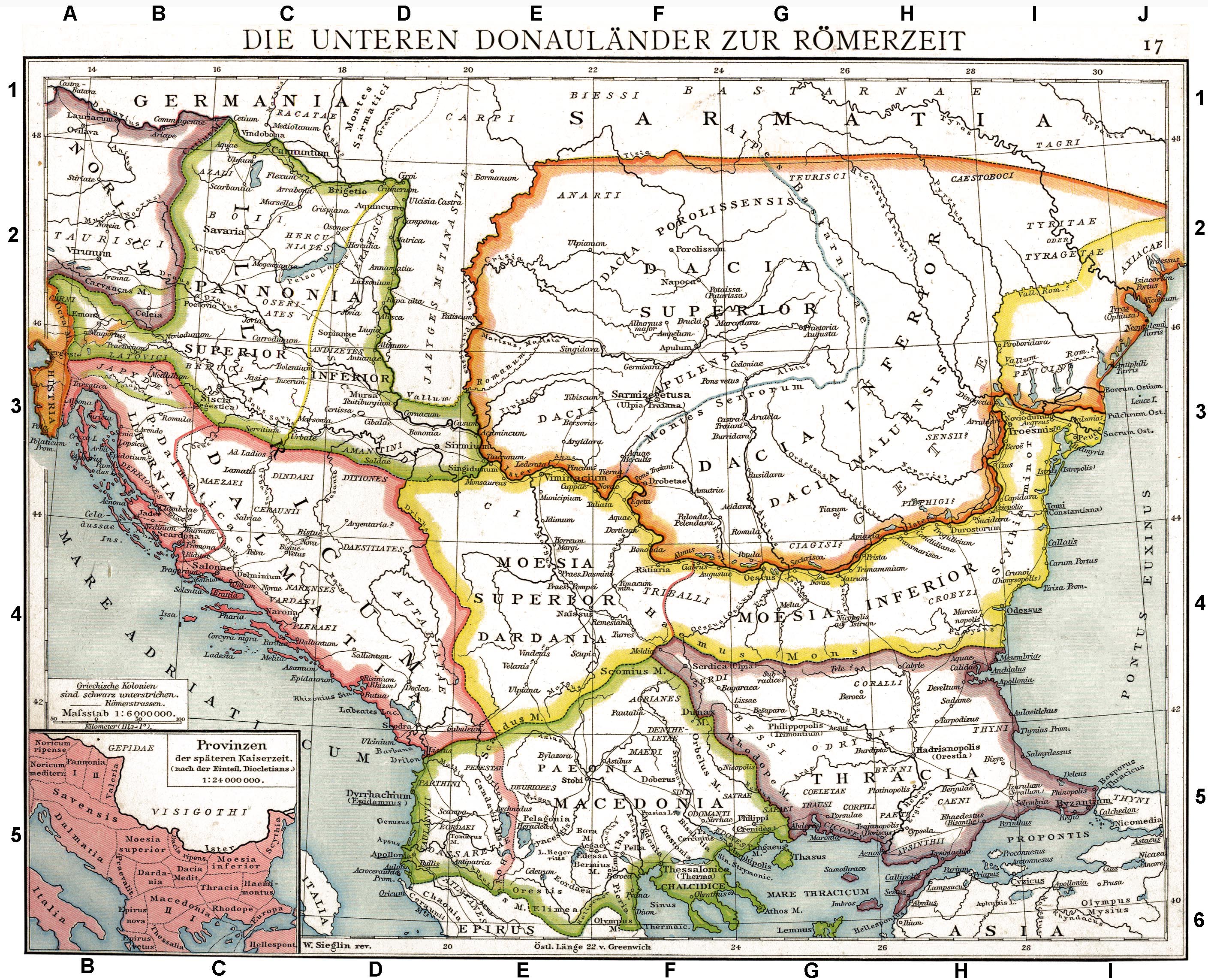
Римске провинције у југоисточној Европи
Source: Die unteren Donauländer zur Römerzeit. Alte historische Karte aus Droysens Historischem Handatlas, 1886; Wikimedia Commons
Провинција Мезија
Када су Римљани успоставили контролу над Илириком, Панонијом и Далмацијом, њихова пажња се неизбежно окренула ка истоку, ка подунавској граници, где је формирана провинција Мезија. Римске кампање у Мезији у 1. веку пре нове ере почеле су из Македоније и биле су мање усмерене на територијално ширење, а више на јачање северне границе провинције, коју су често нападала балканска племена. Ове ране акције нису довеле до трајне римске доминације северно од Балкана, а то је постигнуто тек захваљујући кампањама Марка Лицинија Краса. Године 29–28. пре нове ере, Марко Лициније Крас, гувернер Македоније и унук чувеног тријумвира из Цезаровог времена, предузео је одлучну кампању на Балкану. Као одговор на позив у помоћ племена Дентелети, које су нападали Бастарни, Крас је повео велику офанзиву која је значајне нове територије довела под римску контролу. Према Касију Диону, победио је Дачане и Бастарне, и покорио Мизијце, Серде, Међане, Бесе, Артаке, Гете и друга балканска племена.
Ове акције означиле су почетак трајне римске владавине у Мезији и околним областима. Мезија је потом дошла под римску контролу, иако је регион остао нестабилан. Током владавине Августа, Дачани са севера су више пута прелазили залеђени Дунав, нападајући римске земље и угрожавајући крхку границу. Као одговор, цар је послао искусне команданте попут Секста Елија Ката и Гнеја Корнелија Лентула Аугура (између 1. и 11. године нове ере). Лентул је успео да потисне Дачане преко реке и успоставио је ланац гарнизона дуж десне обале, чиме је поставио темеље мезијског дела дунавског лимеса - утврђене одбрамбене линије која ће постати штит царства против његових северних суседа.
Отпор локалних трачких и гетских племена наставио се и у раним годинама римске владавине, али стално присуство легија и насељавање римских ветерана постепено су мењали лице региона. Римски закон, језик и обичаји су полако почели да се намећу, трансформишући друштвено ткиво Мезије. Процес анексије је био постепен. У почетку је територија била организована као civitas Moesiae et Treballiae са војном влашћу, у којој су освојене земље биле укључене у римски административни модел, али су и даље формално остајале део веће провинције Македоније. Тек око 15. године нове ере Мезија је почела да се доживљава као посебна провинција, иако је и даље била потчињена Македонији. Тек 46. године нове ере добила је пуну провинцијску аутономију, када је и Тракија, која је до тада била независна, такође постала римска провинција.
Војна политика у Мезији пратила је образац успостављен у Илирику и Панонији: успостављање мреже војних база повезаних стратешким путевима. Кључни легијски логор основан је у Ескусу (близу данашњег Гигена), где је Пета македонска легија била стационирана од времена цара Клаудија, а можда чак и пре тога. Пре Римљана, Ескус је био трачко насеље, које се током римске владавине знатно проширило као насеље, достигавши величину и статус колоније под Трајаном (Colonia Ulpia Oescus). Други важни војни центри били су Рацијарија, Сингидунум (данашњи Београд) и Виминацијум. Ови гарнизони чинили су основу римског присуства и редовно су их подржавале помоћне снаге регрутоване из разних делова царства, укључујући Панонију и Далмацију.
Главни дунавски пут, који је пратио ток реке, постао је витална артерија за римску Мезију. Повезивао је војне логоре и омогућавао брзо кретање трупа и залиха. Пут је такође повезивао Мезију са другим важним провинцијама као што су Панонија на западу и Тракија на југу, уклапајући је у опсежни царски систем путева. Временом је ова инфраструктура почела да служи не само војним, већ и економским и културним потребама, подржавајући постепену романизацију провинције.
Ралица Иванова
Подела Мезије
У почетку је провинција била ограничена углавном на уску траку дуж јужне обале Дунава. Али како је локални отпор био угушен и римска власт се учврстила, границе Мезије су се шириле. До краја 1. века нове ере, под царем Домицијаном (87. године нове ере), провинција је подељена на Горњу Мезију (запад) и Доњу Мезију (исток), мера која је била неопходна за административну ефикасност. Домицијан се такође морао носити са новим дачким нападима, што је довело до више војних кампања и неизбежно означило почетак нове фазе у односима са северним суседима Рима под Трајаном. Утврђени лимес, легије стациониране дуж њега, унутрашње војне базе у провинцији, као и могућност брзог кретања дуж Дунавског пута, омогућили су Трајану да ефикасно мобилише своју војску и да је погодно снабдева намирницама током Дачких ратова (101-106. године нове ере). Као резултат тога, постигнуто је освајање Дакије и ширење римске моћи преко Дунава, а Мезија више није била погранична провинција. Међутим, ово се не би могло постићи без упорних и дугорочних напора низа римских владара да стабилизују Мезију и ојачају је од спољних претњи.
Ралица Иванова
Further reading
Александров, Олег. Религията в римската армия в провинция Долна Мизия (I-IV век). УИ" Св. св.Кирил и Методии̌", 2010.
Agnieszka Tomas, Living with the army I. Civil settlements near Roman legionary fortresses in Lower Moesia, Institute of Archaeology. University of Warsaw, Warsaw, 2017, 199p., ISBN 978-83-61376-35-4.
НАСЕЉА
Dionysopolis
(Διονυσόπολις)
On the steep, southern-facing cliffs of the Dobrudzha plateau, where the land meets the Black Sea, lies the ancient city of Dionysopolis, now known as Balchik.
The ancient written sources on Dionysopolis are extremely scarce. They provide no information about the city’s foundation—neither a date nor a mother city is mentioned, which makes reconstructing its early history particularly difficult.
According to some authors, in earlier times, Dionysopolis had another name, Krounoi (Κρουνοί), “The Springs,” named for the fresh water sources in the area. Others state that Krounoi and Dionysopolis were two different settlements. The foundation date is also uncertain, but some hypothesise it originated around the end of the 6th century BC. One of the main hypotheses is that the city was established by Ionian Greeks —the Milesians, or as a secondary colony of another Milesian colony nearby, such as Odessos, i.e., seeking new harbours along the western Black Sea. The coastline in the area was difficult for navigation and lacked deep bays or safe anchorages. Its high cliffs offered some protection from the north winds, and a narrow path connected the harbour to the fertile hinterlands of Dobrudzha. This geography influenced the city’s development, which is thought to have relied more on agriculture and the export of grain rather than fishing.
In the late 4th or early 3rd century BC, the settlement underwent a transformation. Ancient records mention that a statue of Dionysos, god of wine and revelry, was found washed ashore. Thus, the city was renamed Dionysopolis—the city of Dionysos. This particular change reflects some kind of historical event, but it seems unjustified to accept the explanation given by the sources - the miraculous appearance of the divine statue should be considered an etiological myth and not a historical reality.
The population was ethnically mixed: Greeks, Thracians, and later Scythians lived in the city. The Thracian tribe of Krobyzoi (Κρόβυζοι), who inhabited the surrounding lands, may have influenced the worship of Dionysos, which became central to the city’s religious life. Annual Dionysian festivals were held, and inscriptions mention associations devoted to the god. Temples dedicated to Dionysos, the Samothracian Great Gods, Serapis, and others reflect a rich and varied religious environment.
During the Hellenistic period, Dionysopolis prospered as a commercial center. Its terraced streets led down to a small but active harbor. Amphorae from Thasos, Heraclea, and Sinope show extensive trade connections with the broader Greek world. Local coinage featured images of Dionysos and Demeter, highlighting the importance of viticulture and grain production.
By the 1st century AD, Dionysopolis came under Roman control as part of the province of Lower Moesia. In the 3rd century, it became one of the main cities of the province of Scythia. Roman fortifications were built atop older Hellenistic walls; modern excavations have uncovered two towers from these defenses. Despite Roman rule, Dionysopolis maintained some civic autonomy and participated in the Western Pontic Koinon—a league of coastal cities.
This part of the Black Sea coast is characterised by strong seismic activity, so the city periodically faced natural disasters. A particularly strong earthquake in the 1st century BC destroyed the nearby Bizone in the 1st century BC, but did not affect Dionysopolis the same, since the damage there was apparently not so extensive. Nevertheless, in 544-545 AD Dionysopolis was struck by a major catastrophe - a massive sea wave, likely a tsunami triggered by an underwater earthquake, flooded the land up to four miles. Landslides and clay buried large parts of the city. Dionysopolis never fully recovered and remained abandoned for centuries.
The coast was resettled only in the 16th century, when the settlement of Balchik was founded. Beneath its streets lie the remains of Dionysopolis. Archaeological excavations have uncovered temples, rich tombs, coins, inscriptions, and fortifications, revealing a city shaped by Greek, Thracian, and Roman influences.
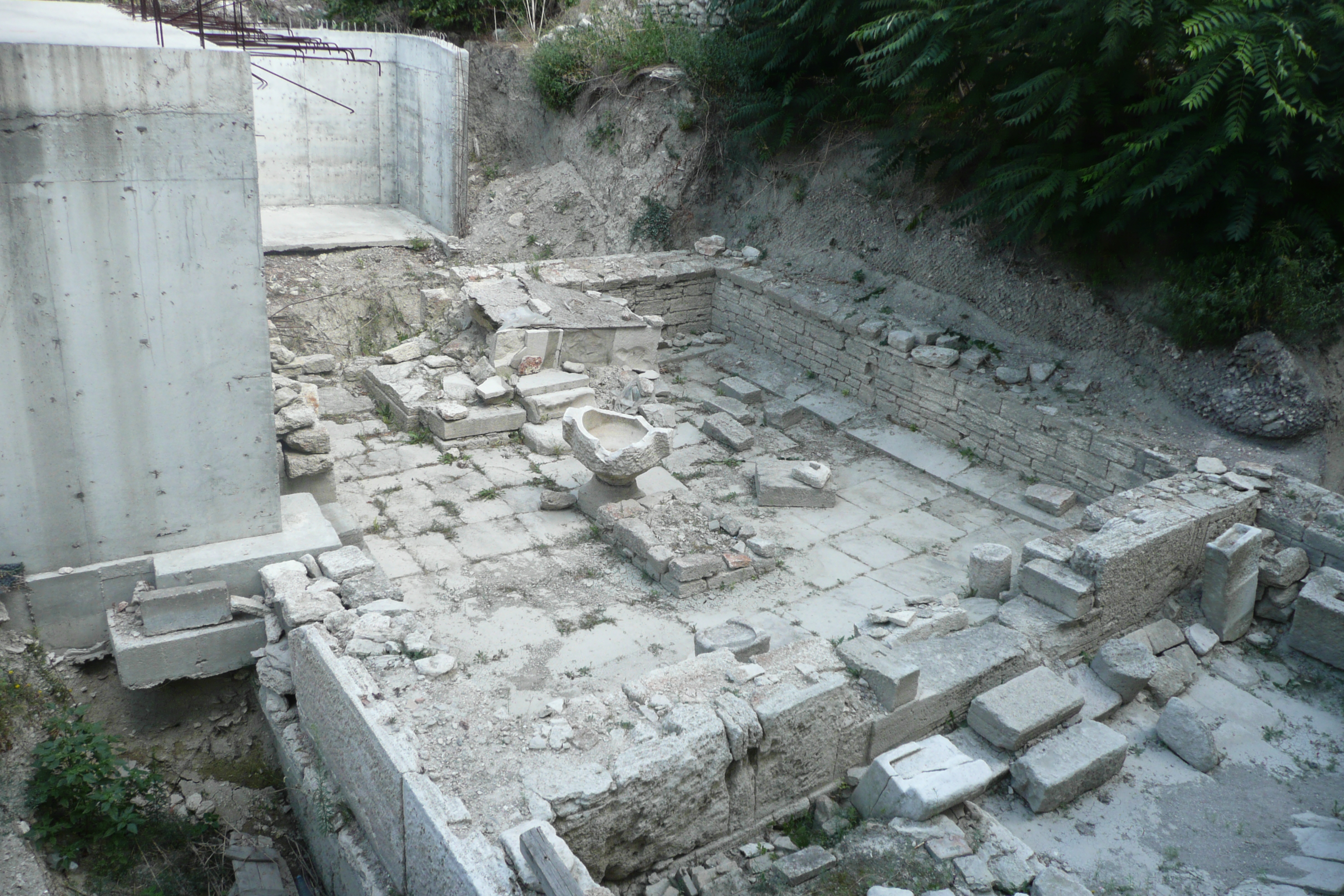
Dionysopolis (today’s Balchik), the temple of the Mother of the Gods
Source: Wikimedia Commons
The temple of the Pontic Mother of the Gods
The Temple of the Pontic Mother of Gods, discovered accidentally in 2007 in Balchik, is the best-preserved Hellenistic temple in Bulgaria and the only one worshipping her as Pontic found so far. Built around 280–260 BC, it remained active until its destruction in the late 4th century AD. An honorary decree found inside ordered that it’d be displayed “in the most prominent place in the city,” showing that the temple was among the most important institutions in Dionysopolis. Inscriptions honouring priests, officials, and cult members span from the Hellenistic period to the 3rd century AD, reflecting continuous worship.
The pronaos served as a public space for inscriptions, statues, and sacrifices visible to outsiders, while the naos held the cult statue and possibly hosted ritual mysteries. Sculptures depict the goddess Cybele as the Pontic Mother of Gods, seated on a throne with a phiale and tympanum, often accompanied by a lion. The main cult statue, from the early 3rd century AD, showed her with a sceptre and lion relief. Other deities, such as Aphrodite, Demeter, and Poseidon, were worshipped alongside her, reflecting overlapping protective roles related to nature, fertility, protection, and sometimes the wild and untamed forces of the earth.
Thracian votive tablets, the second largest group of offerings at the site, highlight the temple’s wider regional importance. During the late 3rd century Gothic invasions, Thracians from the surrounding areas likely sought refuge in the city and protection at the temple. Later, during the Christian persecutions in the late 4th century—following Emperor Constantius II’s decree in 356 AD ordering all pagan temples to be closed—the sanctuary remained one of the last bastions of pagan worship in the region. Evidence of Christian activity against the temple, such as beheaded statues, indicates the building suffered desecration but survived longer than most.
Surprisingly, the building was not destroyed by the tsunami that later buried it under layers of clay and sea deposits. Long before that, it had already been severely damaged, with its walls deliberately brought down to a certain height. This earlier destruction likely resulted from a combination of the Gothic raids and Christian attacks in the late 4th century. Despite all, the temple’s remains—including an extensive collection of inscriptions, statues, and reliefs—constitute the largest known in situ corpus related to the cult of the Mother of Gods, underscoring its profound religious, civic, and maritime significance in Dionysopolis.
Ralitsa Ivanova
Ulpia Oescus
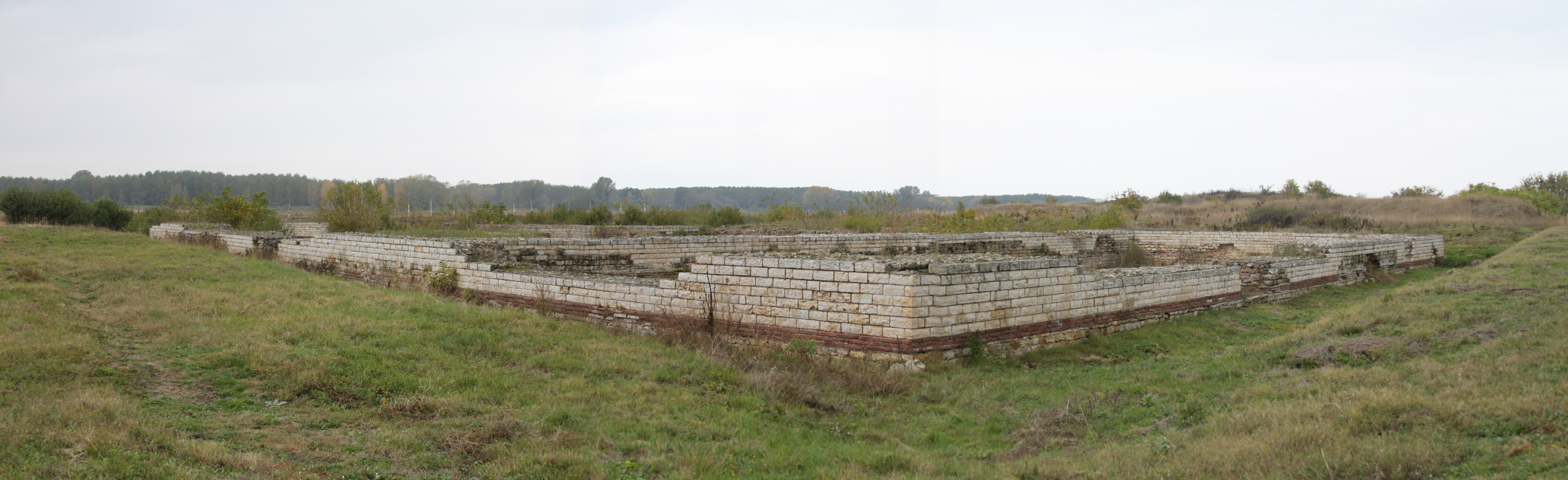
Colonia Ulpia Oescus
Source: Wikimedia Commons
Oescus was originally a settlement of the Thracian Tribali. In the early days of Roman Moesia, a Roman military camp was established, housing Legio V Macedonica and forming part of the Danube limes defensive system along the Limes Moesiae road. The earlier Thracian settlement continued to exist alongside the Roman military presence, and a canabae — a civilian settlement of merchants, craftsmen, retired soldiers, and their families — emerged near the camp. When Domitian split Moesia into two provinces, Oescus became one of the most important urban centers of the new Moesia Inferior. Following his victory over the Dacians (106 CE), Emperor Trajan further elevated its status to the highest rank of Roman urban privilege by founding Colonia Ulpia Oescus and settling veterans there. Its position at the crossroads of the Danube limes road running east and west, the Via Trajana leading south, and routes extending north into Dacia, together with river traffic, turned it into a vital hub of trade, transport, and production.
In the 2nd century, the city flourished: monumental public buildings, a grand forum, a basilica, well-planned paved streets, and temples reflected its urban sophistication. Oescus also became a religious center, with temples dedicated to major Roman deities. Additionally, it became a key hub of craftsmanship and industry, known for its sculpture workshops, mosaic art found in the city, and the production of fine ceramics, metalwork, and glass, marking its prosperity and cultural vibrancy. This period also saw a marked flourishing of Romanization, reflected in the spread of Latin verse inscriptions and the rise of elite cultural practices.
However, later political instability and economic hardships disrupted life in the city. After the Roman withdrawal from Dacia, Oescus regained its military significance and once again hosted Roman legions. The city experienced a brief revival under Emperor Constantine, who in 328 CE commissioned the construction of the largest and most impressive stone bridge across the Danube, celebrating his victory over the Goths. This bridge facilitated the rapid movement of Roman troops while also symbolizing the Empire's strength and dominance over the barbarian tribes threatening its borders. During the turbulent era of the Great Migrations, Oescus withstood multiple barbarian invasions, including those by the Goths and Huns. However, the city was repeatedly destroyed and rebuilt, gradually losing its former splendor. Ultimately, it was abandoned after the Avars and Slavs sacked it in 585 CE. In the Middle Ages, Bulgarians settled over the ruins of Oescus, using the city's remnants as building material for their homes. They remained until the Ottoman invasions displaced them. The ancient city itself was never reinhabited or redeveloped in later periods. The Ottoman Turks instead focused on developing the nearby settlement of Nikopol, which became the last capital of the Bulgarian ruler Tsar Ivan Shishman at the close of the Second Bulgarian Kingdom.
Ralitsa Ivanova
Nicopolis ad Nestum
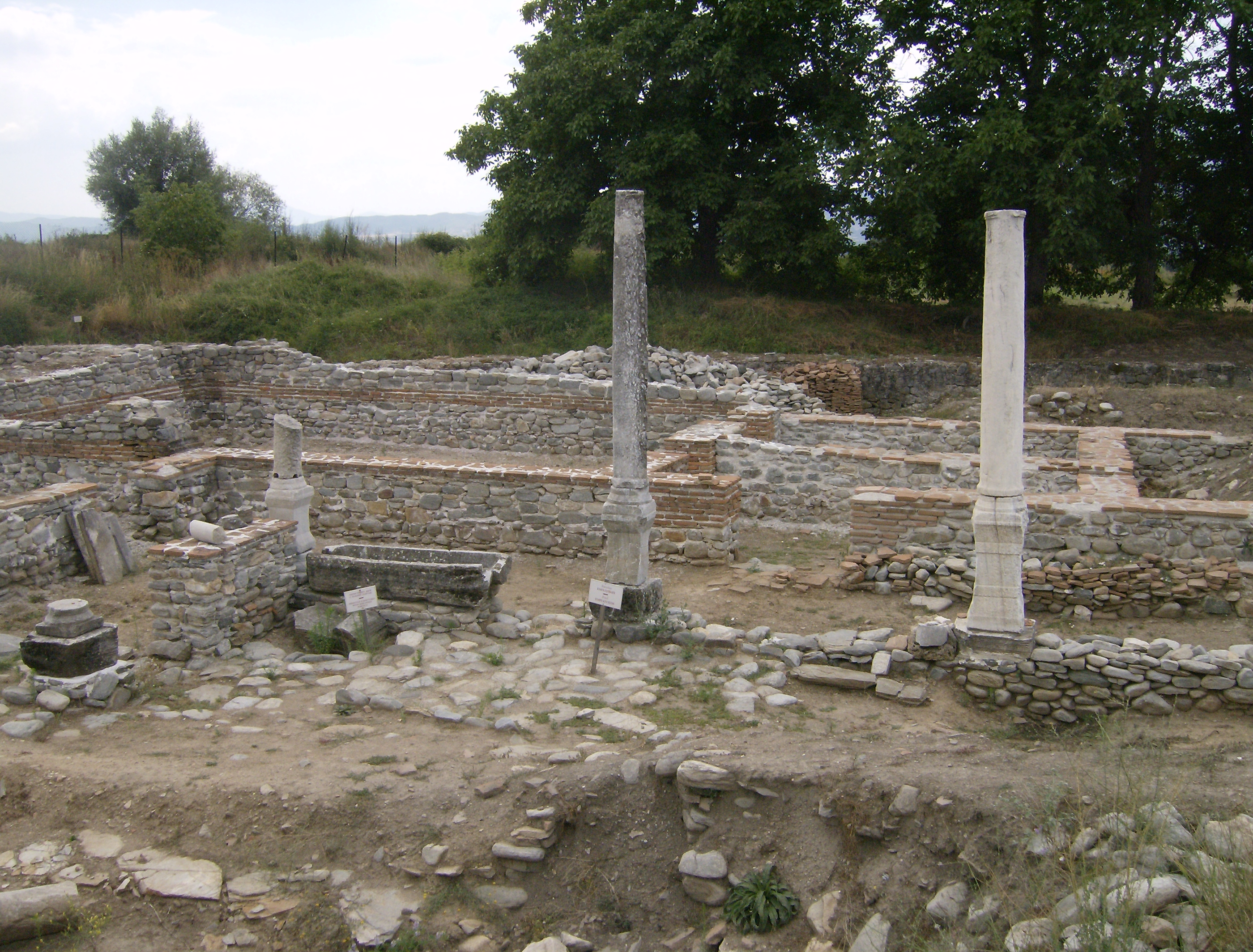
Insula in Nicopolis ad Nestum
Source: Wikimedia Commons
General info and pre-roman period
Nicopolis ad Nestum (“City of Victory”) stood on the Mesta River, about 7 km northeast of the present-day town of Gotse Delchev in Bulgaria. It lay in the southern and southeastern parts of today’s village of Garmen. Two rivers—the Kanina and the Mesta—flow nearby; the name of the latter is of Thracian origin (originally Νέστος, later Μέστος) and it was navigable in antiquity. The city was close enough to the Mesta for transport but far enough to avoid flooding.
The settlement lay before a plain, nestled among the foothills of three mountain ranges: the Rhodope Mountains to the north and northeast, the Slavyanka Mountains to the southeast, and the easternmost slopes of Pirin to the northwest. The surrounding area had numerous hot and cold mineral springs, as well as the two rivers, making Nicopolis ad Nestum the most important center in the Upper and Middle Mesta valley.
Originally agricultural, the city benefited from a mild climate well-suited to fruit-growing. Although farmland was limited, it produced high-quality fruit, furs, and honey, which were traded for goods not locally available. Dense forests provided timber; ore deposits supported metallurgy; and rich marble resources—on par with those of the Aegean coast and Thasos—fueled stone extraction, processing, and trade. Locals also mined clay for ceramics and practiced a variety of crafts.
Its strategic location between the Upper Thracian Plain and the Aegean coast, combined with easy access to the Mesta River, allowed goods (including marble) to be transported to the coast even before the Roman period.
The site was originally inhabited by Thracian tribes, whose names are currently uncertain.
Roman period
Name and foundation of the city
In 106 AD, after his victory over the Dacians, Emperor Trajan created the province of Dacia and named two Thracian cities “cities of victory” — Nicopolis ad Nestum and Nicopolis ad Istrum. However, evidence from earlier research, excavations, and written sources shows that Nicopolis ad Nestum was not founded in 106 AD; it merely received city status and urban rights at that time.
Trajan never visited the Upper and Middle Mesta region, which was far from the Dacian war zone. More likely, he reestablished an existing settlement as part of his program to urbanize Thrace. Since he won no victory there, it is improbable that he named the city Nicopolis to commemorate a battle, unlike Nicopolis ad Istrum, which was tied to a significant Dacian War battle site of victory. Therefore it would seem that Trajan only specified its name topographically in order for it to be distinguished from the newly founded city of Nicopolis ad Istrum, which was technically in the same province (Thrace) until 193 AD. This means that the city on the Mesta must already have been called Nicopolis before Trajan’s reign, though the reason remains uncertain.
The main theory is that the city was originally an older Thracian settlement renamed by Marcus Antonius after his double victory over Brutus and Cassius at Philippi (42 BC), about 60 km away. Although allied with Octavian, Antonius proved the stronger commander, while Octavian suffered two defeats. This gave Antonius major political, social, and military advantages, fueling later rivalry over Caesar’s succession. Once in power, Octavian reshaped history to present himself as the chief victor. After defeating Antonius at Actium (31 BC), Octavian founded two new cities named Nicopolis — in Epirus, near Actium, and in Egypt, near Alexandria — possibly to overshadow Antonius’s Nicopolis and erase memories of Philippi.
Supporting this view, written sources always specify “Nicopolis in Epirus” when referring to Octavian’s city, while Nicopolis ad Nestum appears simply as “Nicopolis,” both in texts and inscriptions. This suggests it was the first and best-known Balkan city of that name before the 2nd century.
Nicopolis ad Nestum in the Roman Period
Following the Roman annexation and the creation of the province of Thrace in the mid-1st century, Nicopolis became part of its administrative structure. Modeled on the Roman Anatolian-style cities, it reached peak cultural prosperity between the 2nd and 6th centuries. Under Emperor Trajan (after AD 107), Thrace was already governed by a legatus Augusti pro praetore, and Nicopolis functioned as a complete civic entity with administrative, religious, and cultural institutions. Drawing on traditions from Greek and Anatolian poleis, the Romans fostered civic associations in the Balkans, such as the Thracian koinon (), to which Nicopolis was linked. Like other Thracian cities, the city belonged to the civitas stipendiaria category, granting it self-government, legal authority, and the right to mint coins.
Its location in a sheltered district far from frontiers and major invasion routes spared it from warfare and raids, allowing for urban expansion without the need of defensive walls. The city followed the Roman orthogonal plan: straight streets aligned to the cardinal points, intersecting at right angles, with the forum/agora at the center. Inscriptions reveal the presence of a boule, demos, and temples. Coinage from Nicopolis depicts emperors and major deities—Apollo, Ares, Artemis, Aesculapius—while votive reliefs show worship of Zeus, Pluto, Hermes, the Thracian Horseman, the river god Mesta, and Dionysus.
Its strategic position between the via Militaris to the north and via Egnatia to the south made it a key trade and transport hub. The Romans expanded mining and metallurgy in the region and exploited local marble deposits, easily moved through the road network and by the river Mesta. By the 4th century, after administrative reorganization, Nicopolis was incorporated into the province of Rhodopa.
Christianity in Nicopolis ad Nestum
Apostle Paul was the first to spread Christianity across the Aegean coast, Macedonia, and southern Thrace, including the valleys of the Mesta and Struma rivers. In the 1st century AD, he founded a church in nearby Philippi—one of the earliest Christian communities in Europe—renowned for its devotion and support to Paul. Elevated to an archbishopric between the 2nd and 4th centuries, the Philippian church oversaw seven bishoprics, one of which may have been Nicopolis. Although Paul’s epistle to Titus mentions a “Nikopol” without specifying which, the absence of “Mesta” in local inscriptions suggests the city was simply called “Nikopol,” consistent with Paul’s wording. This remains a plausible but unconfirmed theory.
After the Edict of Milan in 313 AD—issued by Constantine the Great and Licinius, granting Christianity and all other religions in the empire equal legal status—Nicopolis became an episcopal centre. As the principal urban hub of the Middle Mesta valley in the 4th century, it played a leading role in the region’s Christianization and oversaw extensive church construction. The remains of numerous early Christian temples in the city, nearby villages, and surrounding settlements attest to its influence.
The necropolises of Nicopolis have not been excavated or precisely located yet. Graves have been discovered in multiple locations, indicating several possible burial grounds over time. Evidence shows that Thracian funerary customs persisted until the mid-4th century, after which Christian rites introduced significant changes. Late antique and early Christian burials, dating from the late 4th to early 5th centuries, still preserved certain pagan elements, such as the placement of funerary offerings.
Barbarian Raids
Historical sources record that during the Gothic invasions of 250–251 AD, some tribes advanced into Macedonia through Thrace. Unable to defend its territory or receive aid, Nicopolis made peace with the invaders. The absence of mid-3rd-century destruction layers supports this account.
Persistent threats from other barbarian groups led to the construction of defensive walls in the mid-4th century. Built urgently along with towers and gates, the fortifications enclosed a smaller area, leaving several major public buildings outside the walls.
The city endured until the massive Avar-Slavic invasion of 577–578 AD, when over 100,000 warriors crossed the Danube, ravaged Thrace, and advanced into Macedonia and Thessaly. Archaeological evidence shows that Nicopolis was then burned and completely destroyed.
Byzantine Period
After the city’s destruction in the late 6th century, urban life ceased for roughly three centuries, though nearby settlements persisted. Nicopolis was revived in the 10th century under the name Nikopol, becoming again an important ecclesiastical centre. During this period, control of the region alternated between the First Bulgarian Empire and the Byzantine Empire. The city functioned as a craftsmen’s hub, regained elements of its early Byzantine prominence, and saw its fortifications and some surviving structures rebuilt. From the 10th to 13th centuries, trade between the Aegean coast and the Thracian interior continued.
In 1204, during the Fourth Crusade, the fortress was burned and destroyed, prompting the population to abandon the site and establish a new settlement nearby—Nevrokop. By 1329, Nevrokop (formerly Nicopolis) was recorded as subordinate to the bishopric of Philippi, later passing under the authority of the bishop of Serres.
Later History
Likely a few years after the Battle of Chernomen in 1371, the city came under Ottoman rule. Within the Ottoman Empire, the bishopric of Nevrokop (Nikopol) continued as the Zahnenska and Nevrokopska eparchy (Ιερά Μητρόπολη Ζιχνών και Νευροκοπίου), under the Greek Orthodox archbishopric based in Nea Zichni (Zilyahovo).
As part of modern Bulgaria, the Bulgarian Orthodox Church re-established Nevrokop as an eparchy headed by a bishop. In 1951, the city was officially renamed Gotse Delchev in honor of a regional revolutionary leader.
Ethnic background
Since the province’s creation in AD 45, Nicopolis had absorbed diverse influences, blending Thracian, Hellenized and Romanized Thracian, Greek, Roman, and Anatolian settlers. Christianity, present from at least the 3rd century (and possibly mid-1st, according to Luke), became a major factor in its identity.
In the 1st –early 2nd centuries, when the province of Thrace was established, Thracians were the dominant population in both the city and surrounding settlements.. The exact Thracian tribes inhabiting the Nicopolis region are uncertain, though some of the possibilities include the Bryges, Sapaeans, Odomantoi, Haleti, Diobessi, and Karbileti. Nineteen inscriptions from Nicopolis and nearby villages reveal the community’s public, religious, and ethnic life.
By the 2nd –3rd centuries, prominent families underwent Hellenization, and purely Roman households appeared. The 3rd century also brought new elements—names of eastern origin tied to settlers from Roman Anatolia (Galatia, Lycaonia, and Aphrodisias), including skilled craftsmen such as the sculptor Theodotos. Some of these newcomers were early Christians, their epitaphs reflecting a high level of education.
From the 4th to 6th centuries, barbarian invasions and imperial reforms reshaped the population. In the countryside, Thracian identity persisted, but urban names were now mostly Greek, representing both Greeks and Hellenized Thracians, with Christian names—possibly Thracian—growing more common.
Ralitsa Ivanova
Lychnidus
(Λυχνιδός)
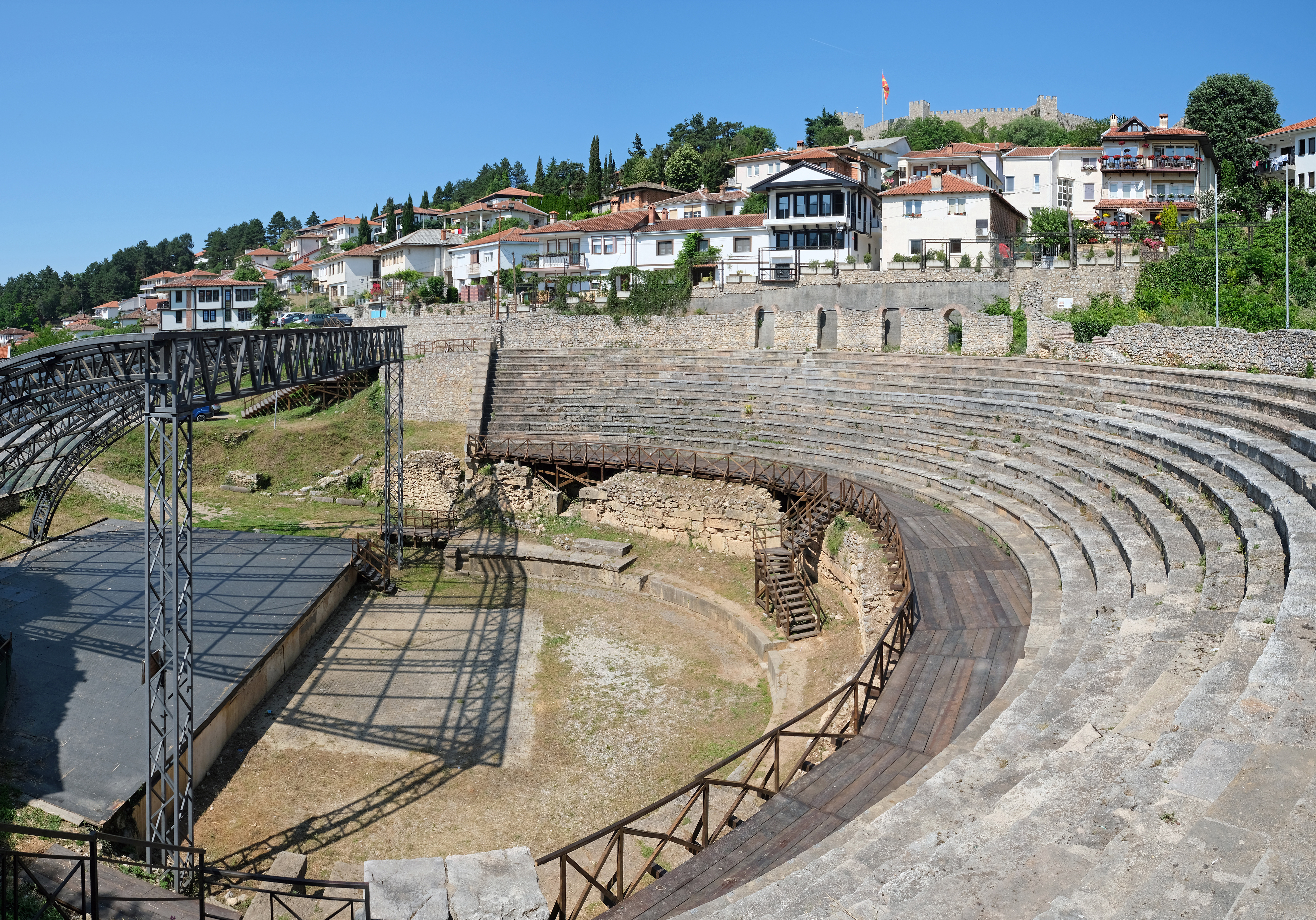
The ancient theatre in today’s Ohrid
Source: Wikimedia Commons
Further reading:
Папазоглу Фанула, Охридско во праисторијата и во античкиот период, Историски прилики, во: Охрид и Охридско низ историјата, Скопје, 1985, 63–124.
Кузман Паско, Старомакедонски симболи на археолошки предмети од Самуиловата Тврдина во Охрид, Folia Archaeologica Balkanica I, 2006, 215–244. (https://paskokuzman-bucket.s3.amazonaws.com/media/publications/files/73165961/73165961.pdf)
Јованова Ленче, Македонија во римскиот период (археологија) во: Македонија, милениумски културно-историски факти, Скопје, 2013, 824-828.
Кузман Паско - Почуча Кузман Нада, Златото на Лихнитида, Охрид, 2014.
Битракова Грозданова Вера / Bitrakova Grozdanova Vera, Лихнид и Дасаретија / Lychnidos et Dassaretie, Скопје 2017.
Bitrakova Grozdanova Vera, Dassarètes et Lychnidiens – Nouvelles sources épigraphiques et numismatiques, Illyrica antiqua in honorem Duje Rendić–Miočević: Proceedings of the International Conference, Šibenik, 12th-15th September 2013, Zagreb 2017, 69–81.
Кузман Паско, Археолошки сегменти на улицата Цар Самуил во Охрид, Археолошки информатор бр. 2, 2018, 61-70. (https://paskokuzman-bucket.s3.amazonaws.com/media/publications/files/1617215251/1617215251.pdf)
Кузман Паско, Античка некропола во Самуиловата Тврдина / Цитадела во Охрид, Monumenta бр. 5, 2020, 279-301 (https://paskokuzman-bucket.s3.amazonaws.com/media/publications/files/1872419604/1872419604.pdf)
Бабамова Славица - Кузман Додевска Калина / Babamova Slavica - Kuzman Dodevska Kalina, Епиграфски споменици од Плаошник - Охрид / Epigraphic monuments from Plaošnik - Ohrid, Охрид
Scupi
(Colonia Flavia felix Dardanorum, Colonia Flavia Scupinorum)
Further reading:
Јованова Ленче, Македонија во римскиот период (археологија), во: Македонија, милениумски културно-историски факти, Скопје, 2013, 834-844.
Јованова Ленче, Скупи – некрополи. Стории за истакнати личности според епиграфски и археолошки сведоштва. Inventaria Archaeologica Personarum том II, Скопје, 2015.
Римски театар Скупи / Roman Theatre Scupi (ed. A. Jakimovski), Скопје, 2017.
Јованова Ленче / Jovanova Lenče - Ончевска Тодоровска Марина / Ončevska Todorovska Marina, Скупи, Сектор југоисточен бедем и комплекс Терма - Базилика со атриум / Scupi, Sector Southeastern Defensive Wall and the Thermae - Atrium Basilica Complex, Скопје, 2018.
Stobi
(Στόβοι)
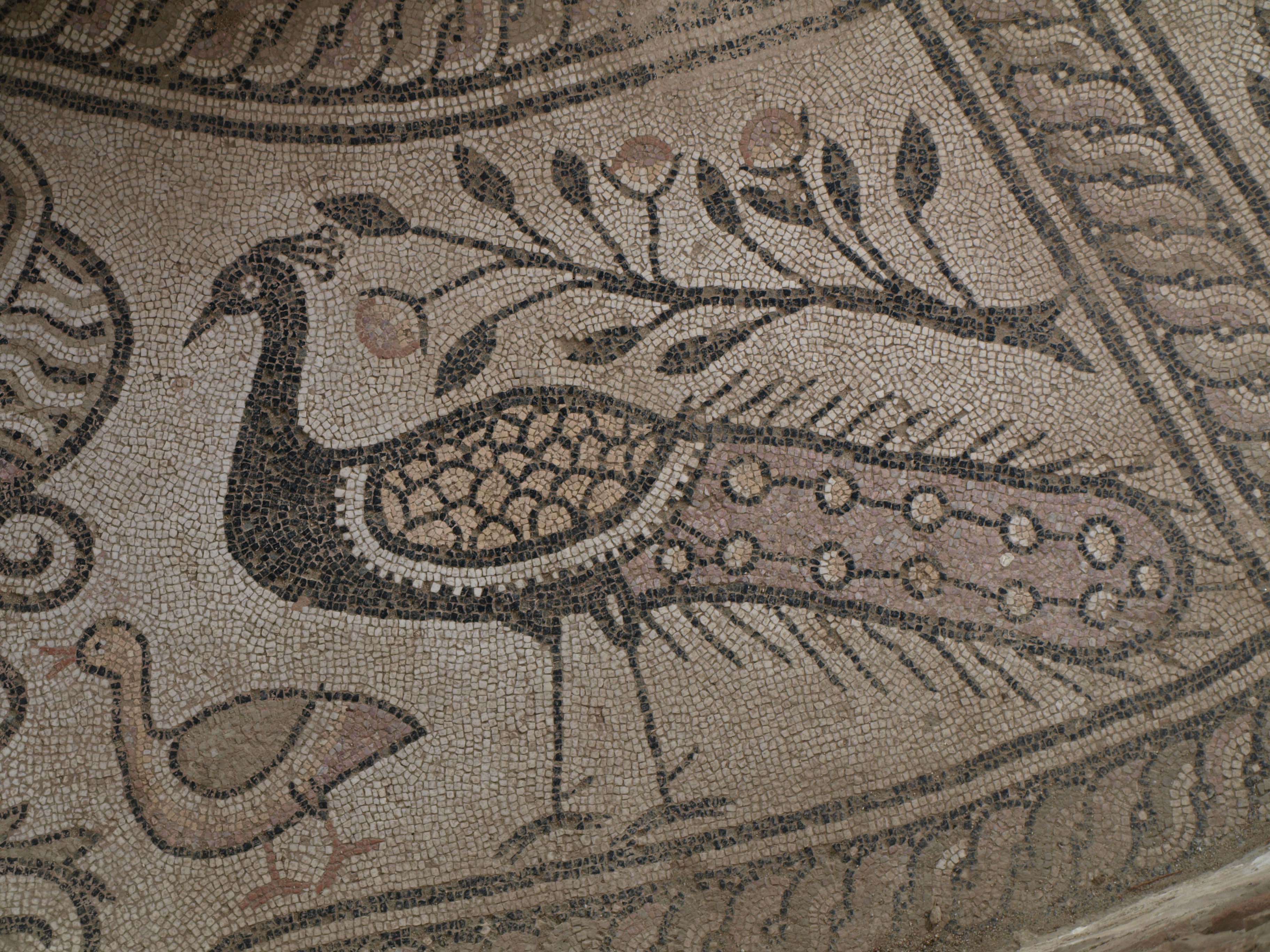
A mosaic found in ancient Stobi
Source: Wikimedia Commons
Further reading:
Papazoglou Fanoula, Oppidum Stobi civium Romanorum et municipium Stobensium, Chiron 16, 1986, 213–237.
Papazoglou Fanoula, Les villes de Macédoine a l’époque romaine, Supplement BCH, Paris 1988, 313-323.
Wiseman James, Archaeology and History at Stobi, Macedonia, in: Ch. B. McClendon (ed.), Rome and the Provinces, New Haven 1986, 37–50.
Wiseman James, The City in Macedonia Secunda, in: Villes et Peuplement dans l’Illyricum protobyzantine, Rome, 1984, 289–314.
Wiseman James, Multidisciplinary Research in Classical Archaeology: An Example from the Balkans, in: Contributions to the Aegean Archaeology: Studies in honor of W. A. McDonald, 1985, 259–281.
Wiseman James, Municipal Tribes and Citizenship in Roman Macedonia, Ancient Macedonia V, 3, 1994, 1757–1763.
Микулчиќ Иван, Стоби, антички град, Скопје, 2003.
Wiseman James, Jews at Stobi, Kačić, Zbornik u čast Emilija Marina, XLI–XLIII, 2009–2011, 325–350.
Јованова Ленче, Македонија во римскиот период (археологија), во: Македонија, милениумски културно-историски факти, Скопје, 2013, 801-810.
Babamova Slavica, Notes on the prosopography of Stobi, Studies in the Antiquities of Stobi IV, 2018, 110-127.
Styberra
(Στύβερρα)
Further reading:
Papazoglou Fanoula, Grecs et Romains à Stuberra, Ancient Macedonia IV, 1986, 431–436.
Papazoglou Fanoula, Les villes de Macédoine a l’époque romaine, Supplement BCH, Paris 1988, 298-302.
Калпаковска Весна, Епиграфски сведоштва за жителите на Стибера, Битола, 2004.
Кепеска Лилјана – Кепески Костадин, Почитување на царскиот култ во Стибера, Maced. acta archaeol. 20, 2011, 317–328.
Јованова Ленче, Македонија во римскиот период (археологија), во: Македонија, милениумски културно-историски факти, Скопје 2013, 818-824.
Singidunum
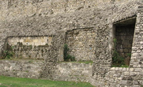
Fragments of ancient Singidunum in the Belgrade fortress
At the site of present-day Belgrade, where the Sava flows into the Danube, stood Singidunum—one of the most important military and urban centres of the Roman province of Upper Moesia (Moesia Superior). Its position on the imperial frontier, on a naturally fortified plateau, made it ideal for controlling both river and land routes, as well as for the interaction of diverse cultures that met along the Danube.
Before it became a legionary fortress and Roman city, the area of modern Belgrade had already been inhabited since prehistoric times. Archaeological evidence confirms continuous life here from the Bronze and Iron Ages, and by the time of the Roman conquest there was already a Celtic stronghold. The name Singidunum dates from the pre-Roman period. Its first part, Singi-, is linked to the tribe of the Singi, while the suffixes -dunum or -dunon, common in Celtic toponymy, mean “hill,” “fortress,” or “fortified place.” Thus, the name literally meant “fortress of the Singi” or “hill of the Singi tribe.” This linguistic pattern appears in many Celtic and Gallo-Roman topony